Blue Wedges speaking out for Port Phillip
and Westernport Bays
UNPRECEDENTED COASTAL EROSION
From Mt. Eliza to the Portarlington locals are noticing erosion and flooding like they’ve never seen before. Portsea beach, and all the way to Pt. Nepean are particularly hard hit and worth a look.
Global warming is increasing sea levels and will continue to do so, SO why did our government deliberately and swiftly increase risks of damage from higher water levels in the Bay by allowing The Entrance to be enlarged and deepened during the Channel Deepening program 2009-2009? Here’s just a few of the dozens of photos we have been sent.
.jpg)
Portsea beach from pier. Looking east towards Pub.
Summer 2011. No better, in fact worse, in 2016, 2017, 2018 and 2019!
Once there were families having fun on golden sands.
Now it’s just a few fossickers picking through the dirty sand.
In 2016, massive sandbags and rockwalls have failed to save the beach. The Andrews government now plans to start all over again, removing the $millions of "expert" solutions.
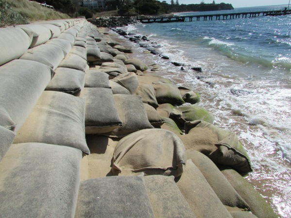
Another failure of another solution 2015
Up until now (August 2019) there has been $ millions spent on multiple studies by various consultants to identify the problem and how to fix it.......one even ventured to opine that the millions tonnes of rock and reef removed at The Entrance was a likely contributor.
DELWP has proposed a permanent rock wall, but some influencial residents just want their beach back and have strenuously resisted this. Another attempt at fixing the sand bag wall is scheduled for later in 2019.
Either way Portsea beach is not the lovely place it used to be pre dredging.
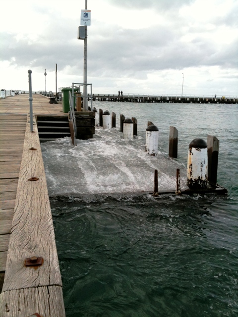 Portsea pier low landing April 2010. Now regularly underwater in calm weather, so not useable to get out of a boat, unless you are happy to step into shin deep water and possible swamping when a swell is on. The low landing has since been raised ~ 30cms. Portsea pier low landing April 2010. Now regularly underwater in calm weather, so not useable to get out of a boat, unless you are happy to step into shin deep water and possible swamping when a swell is on. The low landing has since been raised ~ 30cms.
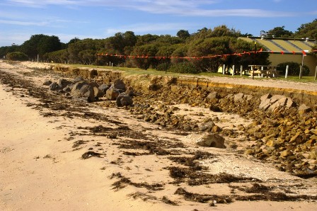 Bellarine. Picnicking here a thing of the past! September 2009 Photo P. Cowden Bellarine. Picnicking here a thing of the past! September 2009 Photo P. Cowden
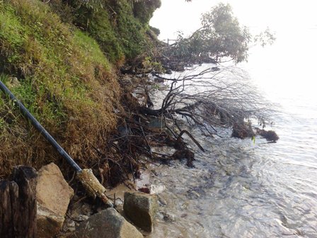 Dog walking beach!! Blairgowrie 18th August 2009. Photo A. Lewins Dog walking beach!! Blairgowrie 18th August 2009. Photo A. Lewins
 No Parking! Pt. Richards 26th August 2009 Photo: P. Cowden No Parking! Pt. Richards 26th August 2009 Photo: P. Cowden
.jpg) Safety Beach cliffs slumping 19th October 2009 . Photo: L. Warfe Safety Beach cliffs slumping 19th October 2009 . Photo: L. Warfe
PoMC admits that tide heights have increased since The Entrance has been dredged, but claim it has had no impact on coastal processes. Have you noticed unusual erosion processes in your area? Please send your photos to us at contact@bluewegdes.org.au
YARRA TOXIC SLUDGE DUMPED IN BAY
The Office of Environmental Monitor (OEM) continues to avoid answering the question.... Why didn’t the PoMC test Yarra sediments for radionuclides? Despite the long but little known history of CSIRO uranium processing near the Yarra River (1940s to 1960s) and a 40+ year history of contamination of the site at 506 Lorimer St. Fishermen’s Bend, that question is still being avoided by the authorities charged with the protection of our health and our environment. Now more than SIX years after we first asked the question we still haven’t been answered!
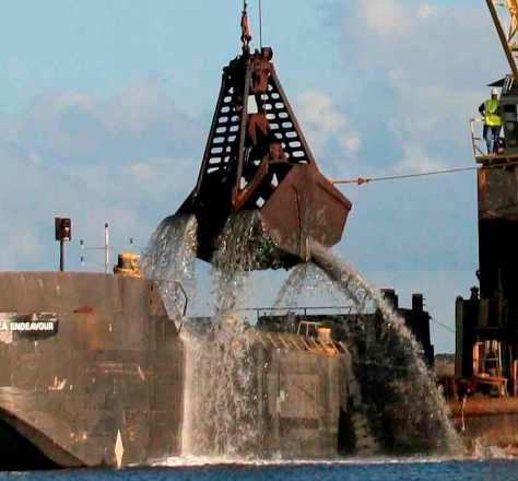 Yarra dredging 21st February 2009. Yarra dredging 21st February 2009.
Note spillage from drag head as it dumps sludge on barge. Here’s the “state of the art” equipment for moving the 3 million tonnes of toxic sediment from the Yarra to the middle of Bay dump site. Looks like something from Dickensian England doesn’t it? While other countries can apparently treat toxic material on land and recycle heavy metals, we are continuing to dig up toxins from the Yarra and then dump them again in the Bay – without the community even having been advised whether any radionuclides are present in the spoil and without the dump site even needing to be licensed by the Environment Protection Authority
Thanks to all our supporters who showed their opposition on land and water to the arrival of the Queen of the Netherlands.
Blue Wedges continues its concerns about the channel deepening project and its aftermath. We have been heartened by the breadth of support from others who opposed this destructive plan for our Bay
Friends of the Earth International had one of its biggest responses ever to its on-line petition opposing channel deepening. Only the Iraq war has out rated Channel Deepening! Thanks to all who took the time to sign it. Garret Gagged by Labour Party on YouTube
Act NOW to keep PoMC responsible for its actions against Port Phillip Bay. Obtain & display banners & stickers. Get info via email
Point Nepean was placed on the National Heritage list in June 2006.
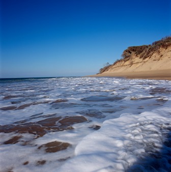 The Bend Point Nepean Photo: P. McConchie The Bend Point Nepean Photo: P. McConchie
Right near here, at The Rip, on 4th April 2008 the Port of Melbourne Corporation started dredging underwater rock walls containing unique sponges and corals. Works at the entrance continued until approx. September 2008.
Plume modelling shows that crushing limestone walls at Rip Bank and Nepean Bank will spread turbidity through The Rip into commonwealth marine areas in Bass Strait and at least as far as Gunnamatta.
POMC booked the dredges in 2004, prior to any environmental assessments being undertaken and prior to receiving any of the necessary approvals. Dredging equipment began arriving in mid January 2008 -just around the corner from this beautiful location.
On December 20th 2007 Environment Minister Garrett approved the project subject to various conditions, including an Environment Management Plan - which he did not approve until 5th February 2008. POMC did not even pay the Federal Court or the Victorian public the courtesy of waiting for the Directions hearing on January 10th before announcing dredges were on the way, and now claims financial imposts incurred because of the Queen of the Netherlands sitting idle from its arrival on 29th January.
Following mediation ordered by the Federal Court, limited dredging commenced on 8th February. Our full case against Mr. Garrett in the Federal Court concluded on 3rd March. On 28th March 2008 the court ruled that Minister Garrett's decision was lawful. Justice North however stated: "It is not the function of the court to make a judgment as to whether the channel deepening project is a good thing or a bad thing, or whether it is harmful to the environment or not. " The court has determined that Mr. Garrett made a lawful decision - he ticked the boxes.
The court was not able to rule whether Garrett made a sensible decision. Clearly he hasn't. Where are the overriding social or economic justifications for such a sustained onslaught to the ecology of the Bay? Just like the Franklin Dam in 1983, the Federal government can intervene in contentious state projects which threaten the environment especially IF it wants to. The EPBC Act has provision for Ministers to revoke decisions.
Watch an early ABC story on You Tube
Have you heard about the unresolved ongoing problems?
1. Toxic sediments – threatening our beaches, our fish stocks, our
health
2. Serious 2005 damage at The Heads – uncontrollable, continuing
rockfall and scour, WHICH EVEN POMC admits could last 30 years
We should all be concerned:
* that our beaches will be contaminated
* about predicted high levels of toxins in local fish, eels and mussels
* about added effects of sea level rise from channel deepening
combined with global warming induced rise, and extreme weather
events
* about flooding in the low-lying coastal areas
The future health and amenity of our Bay will be put at risk for the benefit of a few shipping companies, and “immeasurably minor” benefit to ordinary Victorians.
Ask your local Federal MP's where they stand on Channel Deepening. The Rudd Government was swept to power with Greens preferences. The Greens are opposed to Channel Deepening. If your MP is Labor ask him/her to honour the principled stand taken by the Greens and speak out against Channel Deepening.
Channel deepening is merely PoMC’s Business plan - their outdated dreams for the future - using Port Phillip Bay as their no cost resource. Unfortunately it means big costs to Bay inhabitants, Bay related industries and all lovers of the Bay.
It's time:
* To review and outdated parachial project which threatens our irreplacable marine environment
* To tell Mr. Garrett he has abandoned his principles!
Blue Wedges wishes to thank those generous persons who have recently donated to our campaign. Please accept this acknowledgement as our personal thanks to you.
We can certainly assure you that your donations are being used with the whole-hearted commitment to SAVE THE BAY! If you want to Save the Bay - we need your help NOW as we plan our future camapign and consider further legal action.
Please help with a donation before it is too late!
Help us protect the bay for future generations from threats
like Channel Deepening.
Queen of the Netherlands casting a murky cloud over life in the bay 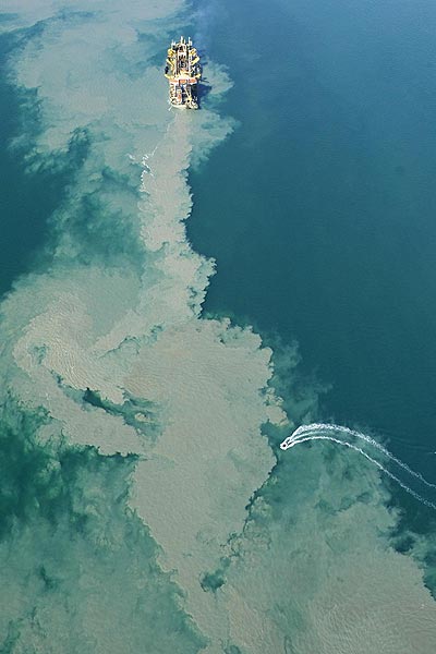 Photo The Age Craig Abraham (Sept 2005) Photo The Age Craig Abraham (Sept 2005)
Whales in the Bay 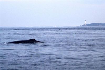
Let’s herald the saving of the whales in Antarctic waters. Let us also be aware of the deathly ambush that awaits these same animals in Port Phillip Bay
I welcome all efforts by the Federal government to stop the inhumane and barbaric practice of whaling in Antarctic waters. Every year many of these magnificent animals come to rest and enjoy the unsullied waters of Port Phillip Bay before continuing to the renowned coastlines of southern Victoria, Western Australia and Queensland where whale tourism flourishes and millions of dollars flow into the coffers.
The Port of Melbourne Corporation’s channel deepening project is a most vile ambush.
Wake up Australia – the eco system cannot be a ‘pie’ to divide up for commerce alone. Our oceans and bays are a highway and time-travelledroute that ensures the survival of the species.
Quote from Judy Muir Polperro Dolphin Swims Sorrentowww.polperro.com.au
-------------------------------------------------------------------------------------------
Scene below around 30 metres before the "trial" dredging in 2005. In its Media Release accompanying the ‘benchmark report’ even the Port of Melbourne Corporation doesn't deny that during the trial, most of the rockfall damage occurred “in the shallow regions above 30 metres…”. That's also where most diving takes place. We now know around 6,000 cubic metres fell - destroying beautiful scenery like this. Not the 20 or so cubic metres first claimed by PoMC.
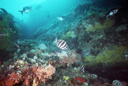
Photo by Greg Blair After the dredging at around 30 metres ,
a spider crab is looking for a new home.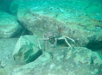
Photo by Alan Beckhurst At 37 metres a boulder weighing several tonnes now covers reef where species of corals, sponges, crustaceans and fish lived!
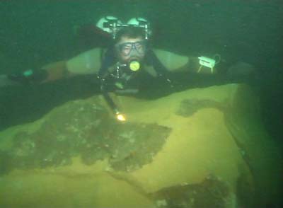
Photo by Alan Beckhurst
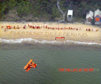
Photo composite: Ian's images
|
.jpg)


.jpg)


